
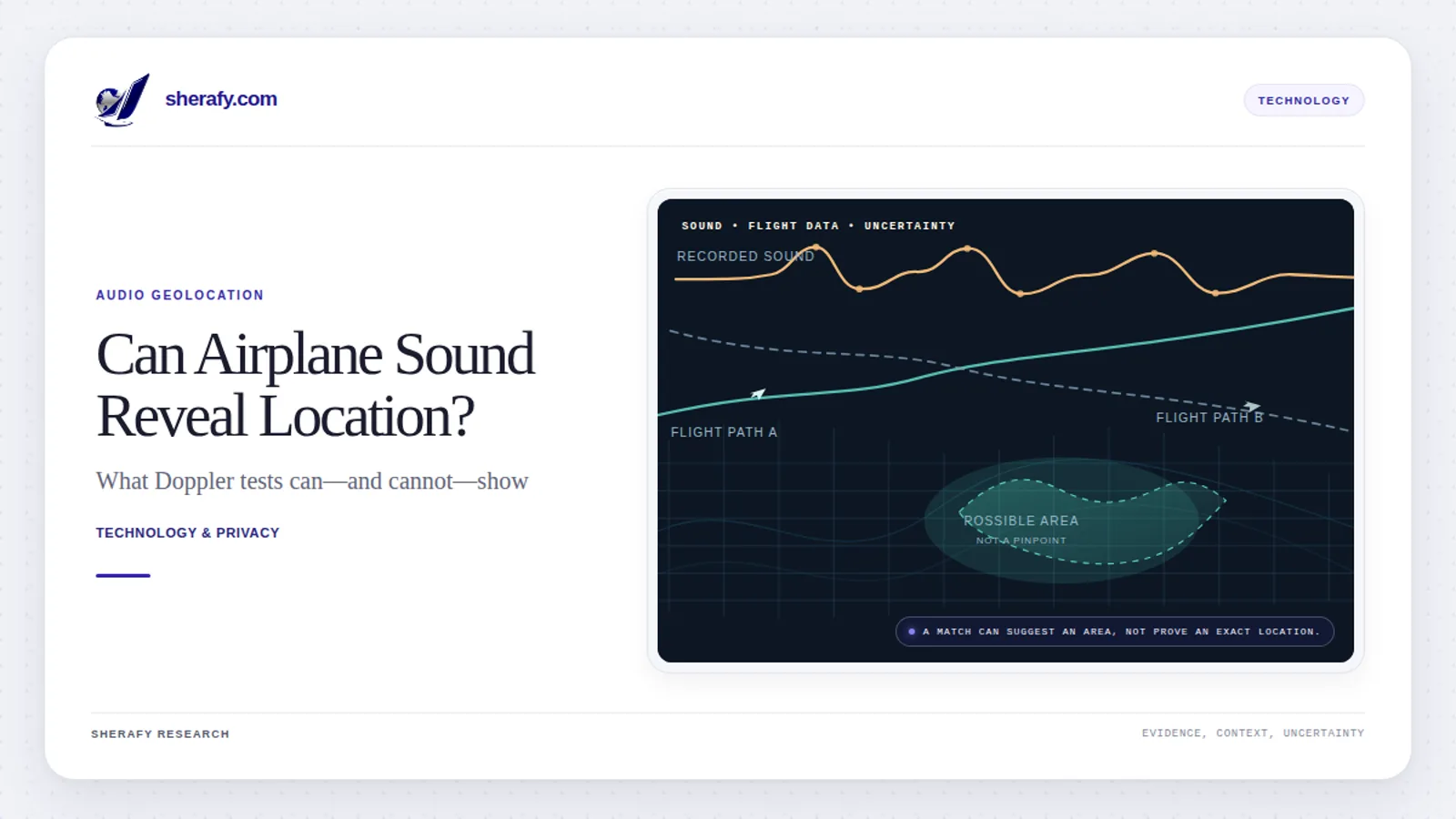
Yes. Under the right conditions, the faint sound of an airplane in a video or audio recording can help reveal where it was made, even without GPS metadata or recognizable landmarks. The technique uses the Doppler effect, which changes the apparent pitch of a moving aircraft, and compares the recorded sound with historical flight-tracking data. It does not extract hidden coordinates from the file. It calculates which possible recording locations would have produced the sound.
But there is an important limit: the claim that this works on any video with sound is not supported by the evidence. A spectacular November 2026 demonstration showed that acoustic geolocation can work. Subsequent tests show that current software often fails, returns no location, or produces convincing but incorrect matches.
The distinction matters. This is neither an imaginary surveillance capability nor a reliable, push-button way to find anyone. It is a real example of something more fundamental: ordinary environmental noise can carry information its recorder never intended to disclose.
Because the method combines public flight records with clues found in media, it is also an open-source intelligence (OSINT) problem; our guide to open-source intelligence introduces the wider discipline.
Key findings:
- The method is physically sound. A passing aircraft's characteristic change in pitch can constrain a microphone's position relative to the aircraft's flight path.
- The viral demonstration was not context-free. The recording date and a broad geographic region were known, and the main analysis used two aircraft passages separated by approximately 15 minutes and 20 seconds.
- Independent implementations have reproduced selected successes, but the results depend heavily on recording quality, available flight data, and how much is already known about when and where the recording was made.
- A November 2026 research preprint provides a needed reality check. In one test at 24 previously unseen locations, the best of three systems succeeded at four sites. In a separate test of 1,600 ordinary public recordings, each system identified no more than two within one kilometer under the researchers' conditions.
- The intelligence principle predates AI. Military acoustic surveillance and aircraft Doppler analysis have long histories. There is no publicly verified basis for claiming that intelligence agencies have used this exact video-location method for 60 years.
The analysis below draws on colsto's original demonstration, the AircraftWitness research paper, its released benchmark and code, historical acoustics research, and official Federal Aviation Administration documentation. The findings of software developers are identified as their own reported tests, not as independent experiments conducted by sherafy.com.
What Did the Viral Airplane-Sound Experiment Actually Show?
On November 2, 2026, the YouTube researcher colsto published a video titled I discovered a sound that leaks your exact location (and it's everywhere).
His challenge was to identify the location of a recording that revealed very little visually. The footage showed a distant, indistinct treeline. There was no visible street sign, storefront, or other obvious landmark to search for.
He did, however, have two pieces of context: the footage had been recorded on September 8, 2026, and its location was somewhere in the contiguous United States. Those facts would become essential to limiting the search.
The two aircraft sounds hidden in the recording
By viewing the audio as a spectrogram, colsto identified faint, curved frequency traces consistent with passing propeller-driven aircraft. Two principal events were separated by approximately 920 seconds, equivalent to 15 minutes and 20 seconds.
That interval was not a location on its own. Thousands of flight combinations could conceivably fit it. But it provided a constraint: a credible candidate microphone location had to be near aircraft whose sounds would arrive at that location with roughly the same time separation.
Colsto reports working with approximately 50 GB of Parquet data, writing more than 5,000 lines of code, and using aircraft trajectories, terrain elevations, and three-dimensional sound-propagation calculations. He began with a relatively coarse 200-meter grid of possible ground locations. After matching candidate aircraft speeds, distances, and timing, about 73,000 points remained. Applying an additional filter based on the absence of a detected aircraft passage between the two events reduced the set to approximately 15,000.
These are creator-reported computational details, not an independently audited reconstruction of his code. Colsto did not publish that original pipeline as an executable package.
The next stage was more discriminating. Instead of asking whether two aircraft passed at roughly the right times, he calculated the complete Doppler curve each candidate position would be expected to hear from the actual archived aircraft trajectories. The closest-fitting combination ranked highest. A finer geographic search and a later Google Street View comparison identified a camera consistent with the original scene.
The result was described as a location estimate within roughly 100 meters. That is an impressive case demonstration, but the distance was not established by an independent survey of the camera's exact position. A high-scoring point, a fine grid, and a measured error against surveyed ground truth are three different things.
What about locating a video from only one minute of audio?
The original video also included a shorter experiment. Colsto took an approximately one-minute excerpt from the same recording, used one faint aircraft signature, and supplied a much more precise recording time: 20:37 UTC. With that additional time information, the correct area again ranked first in his nationwide search.
This result does not mean an arbitrary one-minute social-media clip can be located with no additional clues. The excerpt was not an independent recording selected at random, and knowing the time removed a large part of the search problem.
The two demonstrations illustrate a trade-off:
- When the recording time is uncertain, multiple distinct aircraft passages can supply timing and geometric constraints.
- When the recording time is known closely, one useful aircraft passage may be enough to rank candidate locations in some cases.
Neither condition guarantees success. The remaining ambiguity, flight-data coverage, and audio quality still matter.
How Does the Doppler Effect Reveal a Recording's Location?
The underlying physics is familiar. An ambulance siren sounds higher in pitch as it approaches and lower after it passes. The siren has not necessarily changed what it is emitting. The listener hears a different frequency because the source is moving relative to the listener.
Aircraft produce the same effect. For a propeller-driven plane or helicopter, rotating blades create tonal components that can appear as narrow lines in an audio spectrum. As the aircraft approaches and recedes, those lines can trace a recognizable downward curve.
In some of the public implementations, investigators examined frequencies around 60 to 400 hertz, within the normal audible range. The signal may be too faint or masked by speech, wind, birds, or road noise for a person to notice. “Inaudible” does not necessarily mean ultrasonic or outside human hearing. It can simply mean that the recording contains a weak signal a listener overlooks.
What is a spectrogram?
A spectrogram displays sound in three dimensions of information:
| Spectrogram feature | What it tells the analyst |
|---|---|
| Horizontal axis | When a sound or frequency component occurred |
| Vertical axis | Its frequency, usually measured in hertz |
| Brightness or color | How strongly that frequency appears at that time |
| Curved tonal line | How the apparent frequency changed over time |
| Parallel curves | Possible harmonics from the same source |
The investigation does not depend on recognizing an airplane by ear. Software can search for the geometry of a faint changing tone against a complex background.
It also needs to avoid a trap: three harmonics from one aircraft are not three independent aircraft. They can strengthen identification of one sound source but do not provide the independent flight geometry that a second airplane might.
The physics in one equation
For a stationary microphone and a moving sound source, a useful simplified Doppler relationship is:
f_heard = f0 / (1 + v_radial / c)
Here:
f0is the sound frequency the aircraft emits.cis the speed of sound.v_radialis the rate at which the aircraft-to-microphone distance changes. It is negative while the aircraft approaches and positive while it recedes.
For a hypothetical steady 120 Hz tone and a sound speed of 343 meters per second, a radial approach speed of 60 meters per second would produce an observed frequency of approximately 145 Hz. The same radial speed while moving away would lower the observed frequency to approximately 102 Hz.
Those are illustrative calculations, not measurements from the viral video. A real aircraft's engine or propeller frequency may change, the motion is three-dimensional, and the speed of sound depends on atmospheric conditions. The simple equation establishes the principle; it is not a complete location solver.
The AircraftWitness paper's physical model explicitly relates observed frequency to the changing distance between the aircraft and the hypothetical microphone, with emission time distinguished from the time the sound arrives.
Why the shape of the curve matters more than one pitch measurement
A single pitch measurement tells little without knowing the aircraft's emitted tone. The shape across time adds more information.
For an idealized aircraft moving at steady speed along a straight line, the size and speed of the pitch change depend on its velocity and the distance of closest approach. The investigator can fit candidate curves to estimate plausible combinations of those quantities.
Actual aircraft turn, climb, descend, accelerate, and reduce power. Their paths do not necessarily produce perfect textbook curves. A deviation that looks inconvenient in a simple model may provide additional information when compared with the real recorded flight path.
There are still ambiguities. For example, a single flyover can produce similar acoustic patterns at positions on opposite sides of its path. If the recording clock is uncertain, a candidate location farther along the flight path can sometimes be confused with a different recording time. A second independently identified flight following another route can help distinguish those possibilities.
How Does Public Flight-Tracking Data Turn Sound Into a Map?
The second half of this method is not a secret sensor. It is a public record of aircraft movements.
Automatic Dependent Surveillance–Broadcast (ADS-B) is an aviation surveillance technology in which equipped aircraft transmit information about their position and motion. According to the FAA's ADS-B overview, these broadcasts can include location, altitude, ground speed, and other information. Independent receiving networks record many of the transmissions and make some historical data available.
For example, adsb.lol's historical-data documentation describes daily archives containing aircraft traces and fields such as position, track, altitude, and ground speed.
ADS-B does not track every aircraft. U.S. equipment requirements apply in specified airspace, not universally, as the FAA's rule FAQ explains. Even equipped aircraft may be absent from a particular archive because of reception gaps, data quality, or coverage limits. Some tracking services also use other techniques, such as multilateration, to supplement direct position broadcasts.
The inverse geolocation problem
Conventional acoustic tracking asks: Where is the moving object, given known listening positions?
The 2026 demonstration reversed that relationship: Where is the unknown microphone, given known aircraft trajectories?
Consider a hypothetical airplane whose archived position and velocity are known. At one possible microphone location, the plane would sound relatively close and its pitch would change quickly. A few kilometers away, the passage would have a different apparent timing, intensity, and Doppler shape. Locations on opposite sides of the route could yield similar curves from that aircraft alone.
Each proposed location therefore makes a prediction. The measured audio can support or reject that prediction, subject to uncertainty.
This is better described as inverse acoustic geolocation or aircraft Doppler matching than as ordinary triangulation. Traditional triangulation uses angles or other observations from known positions. Here, investigators compare a recording against a physical model and external flight records.
The seconds lost while sound travels
The aircraft's reported position at the instant a sound is heard is not necessarily where the aircraft was when it made that sound.
If the slant distance is 3,000 meters, sound traveling at 343 meters per second needs approximately 8.7 seconds to reach the microphone. For a moving aircraft, that is a consequential difference.
A technically correct model uses the aircraft's emission-time position and velocity, then accounts for the travel time to the listener. Merely plotting the plane's broadcast position at the listening timestamp can distort the predicted Doppler curve.
Terrain adds another complication. Altitude above a reference datum is not the same as height over the microphone. A camera on a hillside and a camera near sea level can be at different distances from the same aircraft, even when they share a similar horizontal position. Digital elevation models, such as those provided through the U.S. Geological Survey's 3D Elevation Program, help account for ground elevation. Analysts must also distinguish barometric altitude from geometric altitude, because the data are not interchangeable without appropriate treatment.
Can the absence of an airplane sound reveal anything?
Colsto used a period with no detected aircraft signature between his two main events to reject some candidate locations that were predicted to have additional audible aircraft passages.
That is a reasonable potential constraint, but a non-detection is not proof that no airplane passed. An aircraft can be present but too distant, masked, poorly represented in the recording, or absent from the tracking archive. Its engine may not produce a clean tone in the examined frequency band.
Silence can contribute evidence only when the algorithm has a credible model of which sounds should actually have been detectable.
How Accurate Is Audio Geolocation? What Independent Tests Found
This is where the viral headline needs the most scrutiny.
A technique can work on a selected example and still fail on most ordinary recordings. To estimate how useful it is in practice, researchers must measure not only the distance to a correct answer, but also how often the program returns an answer at all and how frequently that answer is wrong.
Early reimplementations: encouraging results with significant advantages
After colsto's video appeared, multiple developers published code implementing variants of the idea. Their findings are valuable, but not directly comparable because the inputs, test boundaries, and ground-truth standards differ.
| Project or evaluation | Reported result | Important condition or limitation |
|---|---|---|
| dopplertrack | A best point approximately 32 m from a reference for the original recording; 627 m for a separate eagle-camera recording | Known-answer cases with a known date; the original camera's reference position was not a surveyed benchmark. A third railway-camera case remained inconclusive. |
| dopplerprint | 27 of 40 Livermore phone recordings within 500 m; median error 207 m | Start time known within about 2 seconds; search radius 4 km; the aircraft passage within each recording was supplied for these benchmark runs. |
| AeroDoppler | In its reported Livermore benchmark, it answered 18 of 29 single-pass phone recordings and abstained on 11; the reported top-candidate median error was 466 m across all 29, with 55% within 500 m and 38% beyond 1 km | Developer-reported results with recording time known within ±2 seconds and a 4 km search box; not a blind, open-ended field test. |
| dopplertrack negative case | A long railway-camera recording did not yield a conclusive correct winner | Flight-track mismatch and a gap in the archived recording undermined otherwise promising candidates. |
The Livermore figures use the publicly released 40-aircraft recording dataset compiled by Praveen Pathak. It includes smartphone audio, extracted frequency measurements, and aircraft flight trajectories. That makes the dataset a useful technical benchmark, although the program is still being tested with substantial prior information.
AeroDoppler reports that its real-recording benchmark used 29 released single-pass phone recordings from the Livermore dataset, with the recording time known within ±2 seconds and a 4 km search box. It returned a candidate for 18 recordings and abstained on 11. Its reported median top-candidate error was 466 m when all 29 cases were counted, including abstentions; 55% were within 500 m and 38% were more than 1 km away. The project notes that a single pass cannot independently verify the recording clock, and it does not grade any of these single-pass results as high confidence. These are the developers’ own benchmark results, not an independent replication.
The developer numbers should not be pooled into one overall success percentage. They do, however, demonstrate that the underlying technique is more than a one-off visual trick.
The November 2026 AircraftWitness study: a much tougher evaluation
The most consequential public test to date is AircraftWitness: How Often Aircraft Can Locate Recordings, a research preprint submitted on November 5, 2026 by Kris Atallah of New York University. The project released its code, benchmark, plans, and test results.
Rather than evaluate only handpicked successful recordings, the researchers tested three location-finding implementations, including dopplerprint, on multiple sets with different degrees of prior knowledge.
| Test | What the programs were given | Reported result within 1 km |
|---|---|---|
| 24 previously unseen recording sites | Five-minute clear-pass audio, a 20 km search square, and a ±300-second clock allowance | Best tested system succeeded at 4 of 24 sites; other systems at 2 and 1 site |
| 360 clear-pass clips from seven sites | GPS-timed recordings, broad location search squares, and detectable aircraft passages | Two implementations found 21 of 360 (5.8%) and 29 of 360 (8.1%) |
| 1,600 randomly sampled public recordings | A 20 km search square and a start time within about 60 seconds, with time-limited processing | The three implementations found 2, 1, and 0 recordings, respectively |
These rows are different experiments, not successive trials drawn from a single population. The 24-site outcome is counted by location, not by individual audio clip. The 360 recordings came from only seven locations, so repeated recordings from the same site are not independent evidence of success across hundreds of places.
The final row is especially instructive. Of the 1,600 randomly selected public recordings, 1,378 yielded audio for the test and some processing was unfinished at the cutoff. A failed download, crash, empty result, or unfinished run counted as a miss. The programs returned few location estimates at all: 13, 20, and 7, depending on the implementation. The figures cannot be generalized to every conceivable attacker, recording, or future tool, but they show how rarely these particular systems succeeded in this time-bounded evaluation of ordinary material.
These tests did not start with zero clues. The researchers supplied a fairly narrow geographic square and approximate recording time. In a completely unconstrained situation, the search would be harder; in a situation where investigators already know the street, camera model, or precise start time, it may be easier.
Does the study demonstrate a real effect, or just lucky guessing?
The researchers compared their results with chance-based expectations and misleading inputs. In the new-location test, the best system's four successful sites exceeded its chance baseline, and wrong-time or swapped-audio controls produced no successful sites for that system.
That supports the conclusion that aircraft noise can contain genuine geographic information. It does not support claiming that the method is broadly reliable.
The paper's limitations section also matters. This is a preprint, not a completed peer-reviewed field standard. Its authors say no outside party executed or scored the experiments. Some comparisons and analysis choices were made after earlier results were examined, and the study's geographic boundaries and assumptions shape the findings.
The defensible conclusion is specific: aircraft Doppler matching demonstrably beats chance in some controlled settings, but current tested tools often cannot locate ordinary recordings and can return wrong answers with substantial confidence.
Why a Convincing Location Match Can Still Be Wrong
An investigator may produce a beautiful heatmap, a sharp maximum, and a predicted curve that appears to follow the spectrogram. None of those alone proves the microphone was there.
There are several reasons:
- The search may exclude the true location. A scoring system can still choose a winner even if every candidate is wrong.
- The aircraft may be misidentified. Several flights can produce partly similar curves, particularly when the recording is short or faint.
- The emitted tone may change. Propeller speed and engine operating conditions introduce variation beyond a simple motion-only model.
- The flight record may be incomplete or inaccurate for the purpose. Missing positions, altitude handling, timestamp errors, and interpolation can shift the predicted signal.
- The audio itself may be discontinuous. Edits, dropped livestream segments, resampling, and clock drift can compromise timing comparisons.
- The benchmark may already supply the answer indirectly. A narrow geographic search or accurately supplied flyover window makes the task different from locating an unknown recording in the wild.
This also explains why confidence scores are not automatically probabilities. A program saying one candidate scored better than another does not mean there is a 95% chance the camera is at that point. That requires independent calibration against many withheld examples, including failures and realistic false matches.
The strongest validation combines independent aircraft events, a consistent shared recording clock, agreement between predicted and observed curves, meaningful controls, and corroboration external to the acoustic model. Even then, researchers should state the uncertainty rather than imply GPS-grade certainty.
Did Intelligence Agencies Already Use This Technology Decades Ago?
A widely shared reaction to the video suggested that modern AI tools are revealing techniques intelligence agencies have been using secretly for sixty years. That claim goes beyond the public evidence.
What is established is more interesting than a speculative attribution: the military and scientific use of weak acoustic signals has an extensive documented history.
The U.S. Navy was analyzing distant sound in the 1950s
The U.S. Navy's Sound Surveillance System (SOSUS) grew from early-1950s work on low-frequency sound detection and underwater listening arrays. Its purpose included detecting and tracking submarines using the sound of their machinery and propulsion systems. The Navy's official history of SOSUS describes the early acoustic research and the roles of Bell Laboratories and Navy organizations. The Office of Naval Research timeline documents the program's development into an operational long-range system.
SOSUS is a useful historical analogy, not proof of the modern video-location method. Fixed hydrophones in known positions were used to detect unknown moving objects. Aircraft-audio geolocation often reverses that arrangement by using known aircraft movements to investigate an unknown stationary microphone.
Aircraft Doppler analysis is not new
In 1992, Brian G. Ferguson published research on estimating the speed and altitude of propeller aircraft using narrowband acoustic observations.
In 1993, Ferguson published an experimental analysis of Doppler-shifted propeller blade-rate signals recorded from an aircraft. Further 1994 research by Ferguson and Barry G. Quinn examined signal-processing techniques for aircraft acoustic localization.
A 2013 study in Aerospace Science and Technology described passive aircraft tracking using acoustic Doppler measurements from a network of microphones.
These studies establish that extracting motion information from aircraft sound is a mature scientific idea. They do not establish that a government agency used the exact 2026 combination of a stranger's recording, public flight archives, and a nationwide inverse-location search decades earlier.
Another example: electrical-grid hum as forensic evidence
Aircraft are not the only source of incidental signals. In a 2007 Forensic Science International paper, Catalin Grigoras described how small variations in electrical network frequency, when embedded in recordings and compared with reference information, could help assess recording integrity and timing.
This electrical network frequency (ENF) technique is distinct from aircraft Doppler matching. It nevertheless illustrates the broader intelligence principle: a recording can reveal facts about the environment in which it was created without its maker knowingly including those facts.
We can reasonably conclude that intelligence organizations have long understood the value of acoustic signatures. We cannot responsibly conclude, from that history alone, that the CIA, NSA, or another specific agency has secretly used colsto's exact method for sixty years. No verified public documentation established that claim in the sources reviewed for this article.
What Do AI and Large Language Models Change?
The 2026 demonstration was not an LLM inventing a new law of physics. The Doppler effect, spectral analysis, and aircraft-tracking data already existed.
The change is in how accessible the combination can become. Developers now have public flight archives, scientific Python libraries, digital mapping tools, reasonably powerful computers, and AI coding assistants that can help translate a technical concept into working software.
The release of projects such as dopplertrack, dopplerprint, and AeroDoppler demonstrates how quickly a public research idea can acquire independent implementations.
That does not mean an AI assistant can simply listen to any video and identify a house. Building software is one thing; producing accurate acoustic measurements, identifying the correct flights, managing incomplete records, and distinguishing valid matches from false positives are separate problems.
AI may reduce the cost of attempting the analysis. It does not remove the physical limits of the evidence.
Can Someone Find Your Home, Workplace, or Livestream Location From Sound?
Potentially, yes, when a recording contains usable aircraft signatures and an investigator can constrain the search. But the risk is not uniform across all videos.
A short indoor clip with speech and music may provide little usable signal. A longer outdoor recording may capture several aircraft. A stationary security camera or repeated livestream may provide many opportunities to test the same unknown location over time. A known recording timestamp can substantially reduce the ambiguity.
The key practical variables are:
| Factor | Why it matters |
|---|---|
| Recording length | Longer recordings may capture more distinct aircraft and more usable timing information. |
| Exact or approximate time | A known timestamp narrows the historical flight records that must be compared. |
| Approximate region | Knowing the city or a 20 km search area is a very different challenge from searching an entire country. |
| Aircraft type and proximity | Propeller aircraft and helicopters often produce more useful narrowband signatures than distant aircraft without a stable tone. |
| Microphone and environment | Walls, weather, traffic, wind, and recording settings affect what survives in the audio. |
| Repeated recordings | Several clips from one location can collectively provide more evidence than one brief clip. |
| Flight archive completeness | Missing or inaccurate tracks can make matching impossible or misleading. |
These factors affect the plausibility of a successful analysis; they are not a validated individual risk calculator.
Also, this is not the only way a recording can disclose location. Visible landmarks, spoken place names, reflections, weather, local wildlife, transit sounds, metadata, and posting patterns may offer easier clues. Colsto himself acknowledged in his video that there are often simpler ways to locate someone than running this analysis.
For individuals whose safety depends on keeping a location private, the practical lesson is to evaluate the entire recording, not merely the GPS tag or what appears on screen.
Can Noise Reduction, Audio Compression, or Editing Protect Your Location?
Some audio processing can make this method substantially harder. Other processing has little effect. There is no honest basis for a universal claim that all noise reduction fails or that one filter guarantees anonymity.
The AircraftWitness paper's noise-processing experiments provide an unusually useful comparison. Researchers examined 35 held-out audio windows without speech and counted how often their aircraft-pass detector still found a signal after each treatment.
| Audio treatment | Audio windows where the tested detector still found an aircraft pass |
|---|---|
| Original, untreated audio | 30 of 35 |
| FFmpeg standard spectral noise reduction | 28 of 35 |
| Stronger FFmpeg spectral noise reduction | 20 of 35 |
| Opus compression at 16 kb/s | 23 of 35 |
| RNNoise | 2 of 35 |
| Tested tone-removal method | 0 of 35 |
What these figures mean: For this detector, this dataset, and these processing settings, several ordinary methods preserved much of the detectable aircraft signal, while others substantially reduced detection.
What they do not mean: A recording with a missed aircraft detection is proven impossible to geolocate. The researchers did not test every conceivable analyst or an informed adversary adapting the analysis to altered audio. Nor does passing a signal detector mean a full location search will succeed.
There are three practical takeaways:
- Removing metadata is not enough. This is a property of recorded sound, not a GPS tag.
- Compression alone should not be treated as protection. Some low-bitrate processed recordings still retained detectable aircraft signatures.
- Removing or replacing the original ambient soundtrack prevents this particular analysis from using that soundtrack. It does not remove visual clues, information spoken in the video, location information elsewhere in the file, or evidence from other recordings.
Aggressive filtering may also damage speech. A decision about privacy should account for what the recording is meant to preserve, whether the original remains accessible elsewhere, and whether a substitute soundtrack genuinely excludes the sensitive audio.
Frequently Asked Questions About Audio Geolocation
Can someone find my location from a video without GPS metadata?
Yes, sometimes. GPS metadata is only one possible source of location information. Distinctive background sounds can be compared with outside records, including aircraft flight tracks. Whether a particular recording can be located is a separate question.
Does audio geolocation work on any video with sound?
No. The viral phrasing is too broad. The method needs useful acoustic evidence and enough information to distinguish a true match from alternatives. In the November 2026 tests, the evaluated systems almost never successfully located randomly selected public recordings.
Can a single airplane reveal where a recording was made?
Sometimes, especially when the recording time and approximate region are already known. One aircraft may leave mirror-image or time-offset ambiguities. Multiple distinct aircraft can improve the constraints, but do not guarantee accuracy.
Can airplane sounds reveal location indoors?
Potentially. Lower-frequency aircraft sound can enter buildings, but the surviving signal depends on construction, distance, microphone placement, ambient noise, and processing. The fact that some indoor recordings may contain detectable tones does not mean indoor recordings are routinely locatable.
Is this the same as GPS tracking or triangulation?
No. The audio does not transmit GPS coordinates. The method estimates a recording position by comparing the measured Doppler pattern with a physical model of known aircraft flights. It is a form of inverse acoustic geolocation.
Does the investigator need to know the recording time?
Not necessarily, but timing information helps substantially. Colsto's two-aircraft demonstration used the recording date and relative timing between aircraft. His one-minute demonstration used a closely known recording time. Neither result should be generalized to an unknown clip with no time or geographic context.
Can this technique work on a telephone call?
It is physically plausible in some circumstances, but not established as a reliable way to locate arbitrary callers. A call may have a known timestamp, yet microphone placement, speech processing, noise suppression, and the absence of usable aircraft signatures can prevent a match. A laboratory-style phone-audio demonstration is not a large-scale performance test.
Can AI automatically locate someone just by listening to a recording?
Not reliably with the published systems evaluated here. AI-assisted coding can make the research easier to implement. Actual location estimates still depend on acoustic evidence, flight data, modeling assumptions, and successful validation.
Could the same approach help verify that a recording's stated location is genuine?
Yes, in principle. If the location and time are claimed in advance, the problem becomes a consistency check: should the recorded aircraft signatures agree with the historical flights at that place and time? The AircraftWitness authors explored this forensic use, but report limited coverage. A lack of acoustic confirmation is not proof that a recording is fabricated.
Final Assessment: The Risk Is Real, but the Viral Claim Goes Too Far
Aircraft Doppler geolocation demonstrates a legitimate forensic capability. It can extract geographic evidence from sound that a person may not recognize as meaningful, then compare that evidence with independent records of the physical world.
What it has not demonstrated is the ability to reveal the exact location of virtually any recording. The strongest available tests show successes that exceed chance under certain conditions, alongside far more failed or unanswered attempts when the recordings are less favorable.
That is the distinction worth keeping: a microphone does not have to record your GPS coordinates to record clues about where it was.
References and Further Reading
Original Demonstration and Reproducible Research
- Colsto, I discovered a sound that leaks your exact location (and it's everywhere) (YouTube, November 2, 2026). The original demonstration. Establishes the creator's stated inputs, the two-aircraft search, the separate known-time one-minute test, and the proposed privacy implications. Results are creator-reported.
- Atallah, AircraftWitness: How Often Aircraft Can Locate Recordings (arXiv, November 5, 2026). Primary research preprint assessing multiple geolocation implementations with controls, new recording sites, public-recording samples, and audio-processing tests. Not yet treated here as independently peer-reviewed.
- AircraftWitness research code, datasets, and registered test plans (GitHub). Supporting research materials and scoring protocols for the preprint.
- Pathak, Aeroplane Data: Full Analysis and Raw Files (Zenodo, October 16, 2026). Dataset containing 40 smartphone-recorded aircraft passages near Livermore, California, with derived measurements and corresponding flight trajectories.
- Dopplertrack: Acoustic Geolocation From Propeller-Aircraft Doppler Curves (GitHub). Independent implementation with successful case studies, a negative example, and discussion of false matches.
- Dopplerprint: Aircraft-Doppler Audio Location Research Software (GitHub). Independent implementation with reported Livermore benchmark results, explicit prior-information requirements, and documented limitations.
- AeroDoppler: Local-First Aircraft Audio Geolocation (GitHub). Additional independent implementation and real-recording benchmark, with consent and uncertainty cautions.
Aviation, Geospatial Data, and Governing Rules
- Federal Aviation Administration, ADS-B Ins and Outs. Official explanation of aircraft broadcasts and the data they can include.
- Federal Aviation Administration, ADS-B Frequently Asked Questions. Explains equipment requirements and why ADS-B participation is not universal.
- adsb.lol, Historical Data Documentation. Describes the independent network's public aircraft-history archives and data fields.
- U.S. Geological Survey, 3D Elevation Program. Official source for the elevation-data infrastructure used in terrain-aware geographic modeling.
Historical Acoustic Intelligence and Signal Processing
- U.S. Navy, Origins of SOSUS. Declassified institutional history of low-frequency acoustic surveillance and early submarine-detection research.
- Office of Naval Research, Historical Timeline: SOSUS. Confirms the Navy's early planning and operational history of long-range sound surveillance.
- Ferguson, A Ground-Based Narrow-Band Passive Acoustic Technique for Estimating the Altitude and Speed of a Propeller-Driven Aircraft (1992). Early scientific work on estimating aircraft motion using acoustic observations.
- Ferguson, Doppler Effect for Sound Emitted by a Moving Airborne Source (1993). Experimental paper measuring propeller blade-rate Doppler shifts from a moving aircraft.
- Ferguson and Quinn, Application of the Short-Time Fourier Transform and the Wigner–Ville Distribution to the Acoustic Localization of Aircraft (1994). Shows the established use of time-frequency analysis in aircraft acoustics.
- Martín and colleagues, Aircraft Tracking by Means of the Acoustical Doppler Effect (2013). Investigates aircraft tracking using signals from distributed microphones; a related but different measurement geometry.
- Grigoras, Applications of ENF Criterion in Forensic Audio, Video, Computer and Telecommunication Analysis (2007). Documents a separate method for using incidental electrical-grid signals to assess recorded media.
Editorial currency note: Research, available code, benchmark results, aircraft-data archives, and aviation requirements may change. This assessment reflects publicly available sources reviewed through November 12, 2026. Reported tests have not been independently rerun by sherafy.com, and their results should not be interpreted as universal success rates.
16:9 Featured Image Prompt: An editorial scientific visualization of acoustic geolocation, showing a faint, curved aircraft Doppler signature on a spectrogram at left and several anonymized aircraft flight paths above a topographic map at right, linked by fine analytical lines to a broad, deliberately non-specific area of possible microphone positions. Documentary intelligence-briefing aesthetic; restrained colors, high contrast, realistic spectrogram geometry, no human targets, no identifiable private address or exact location pin, no dramatic surveillance crosshairs, no text overlay. Landscape 16:9 composition with clear visual hierarchy and generous safe space for responsive cropping.