Could you survive the Darién Gap alone? Possibly, but there is no reliable survival probability for an unaccompanied person, and no generally safe independent walking route to recommend. Your chances would depend on your exact location, weather, health, equipment, communications, exposure to criminal violence, and the decisions you make when conditions deteriorate. The U.S. State Department currently classifies specified parts of the Darién as Level 4, Do Not Travel, citing crime and extremely limited emergency assistance.
The danger is not one spectacular predator or one impossible mountain. It is the way ordinary problems become connected. A wet boot produces a blister. A blister changes your gait. An altered gait makes a fall more likely. An injury slows you down, consuming food and daylight. A swollen river now blocks your return. One bad decision compounds the next.
This guide uses a hypothetical solitary-survival emergency to explain the real geography, history, wildlife, medicine, human threats, equipment, and judgment the Darién demands. It is not a route guide, an invitation to attempt a crossing, or a substitute for rescue and medical care. Hundreds of thousands of people crossed the region during recent migration peaks, many under desperate conditions, but their journeys cannot be used to calculate the odds for an unsupported individual.
The first principle: surviving the Darién Gap and crossing the Darién Gap are not necessarily the same goal.
Imagine You Are Alone in the Darién Gap
Your clothes are soaked. Your boots have been wet for most of the day. The last reliable map position is behind you. Your phone has power, but no cellular signal. You can hear a river somewhere below the hillside, and the rain is getting heavier. You have some food, a water-treatment device, and a pack of equipment you have never needed quite this badly.
There is no visible road, settlement, or clear exit. You do not know whether the nearest help is two hours away or two days away. You cannot see the landscape beyond the canopy.
An adventure story tells you to keep moving. A survival assessment starts with different questions:
- Am I in immediate danger where I stand? Rising water, unstable ground, falling branches, or a human threat may require moving to safety.
- Do I know my location? A compass heading without a verified destination is not a plan.
- Can I alert someone? Emergency communications may be more valuable than another hour of walking.
- Am I still medically capable of moving? Heat stress, injury, fever, or dehydration changes the risk of every decision.
- Is it safer to remain here, retrace a known route, or move toward verified assistance? These are distinct choices, and none is automatically correct.
The U.S. National Park Service's lost-person guidance supports establishing a location, retracing steps only when safe, seeking help, and remaining in a safe place when movement would make rescue harder. The principle is relevant, but rescue in the Darién can be far more difficult than in a managed park.
We will return to this traveler as the situation changes.
Where Is the Darién Gap, and Why Is It So Difficult?
The Darién Gap straddles the border between eastern Panama and northwestern Colombia, linking the landmasses of Central and South America. It is famous because the Pan-American Highway network is interrupted here. Panama's highway reaches Yaviza, but no continuous conventional highway runs through the border wilderness to Colombia. The State Department's Panama guidance confirms the road ends at Yaviza.
The missing road connection is commonly described as roughly 60 to 66 miles (about 100 kilometers). That is not a measured walking route or a distance that can be divided by a normal hiking speed. The length of any real journey depends on the starting point, terrain, weather, rivers, restrictions, and usable paths. A straight line can conceal mountains, ravines, or wetlands that force major changes of direction.
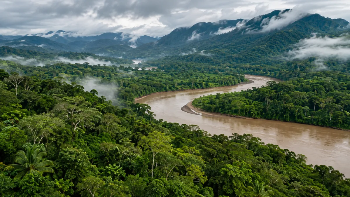
The environment is not one endless, uniform jungle. UNESCO describes Darién National Park as an approximately 575,000-hectare protected landscape encompassing Pacific coastline, mangroves, wetlands, rivers, lowland rainforest, and forested mountains reaching 1,875 meters (6,152 feet) at Cerro Tacarcuna. The park is only part of the wider Darién region.
That distinction is crucial. A marsh is not a mountain. A coastal mangrove is not a dry ridge. A river valley may offer a prominent feature to a navigator and still trap a person between flooded banks. Techniques that work in one habitat may become dangerous in the next.
Is the Darién an uninhabited wilderness?
No. Indigenous peoples, including Emberá, Wounaan, and Guna communities, have deep histories and continuing ties to the region, alongside Afro-descendant and other residents. Their communities are not scenery and should never be lumped together with criminal organizations. UNESCO's World Heritage account explicitly recognizes the area's cultural as well as ecological importance.
The modern image of an impenetrable jungle also needs qualification. Many people have crossed it, but often with others and with varying access to local knowledge, transportation, or paid assistance. Some of those arrangements involved serious exploitation. An isolated stranger cannot assume that a historical migration corridor would be identifiable, accessible, or safe.
How Much Does It Rain in the Darién Gap?
Rainfall varies across the region. The UNEP-WCMC Darién National Park datasheet describes annual precipitation of roughly 1,800-2,500 millimeters in the central valley, 3,000-4,000 millimeters in Caribbean-facing mountains, and 4,000-5,000 millimeters on the Pacific-facing side. These are regional ecological estimates, not a forecast for one hiking location or a measurement of current river levels.
The datasheet describes a relatively drier period around January through March, less pronounced toward the Colombian border. "Dry season" never means dry ground, stable rivers, or a safe crossing. A local storm can still change the hazards within hours.
Why Hasn't the Pan-American Highway Been Built Through It?
The missing highway is not simply an engineering problem. It is the product of costs, terrain, animal-disease controls, environmental protection, territorial rights, and political choices.
A 1978 U.S. Government Accountability Office report documented a 1971 agreement by the United States, Colombia, and Panama to complete the connection. Estimated costs rose from $150 million in 1968 to $285 million in 1977, while funding, legal obstacles, and concerns about foot-and-mouth disease complicated the project. Those are historical figures, not an estimate for building a road today.
Contemporary objections also concern deforestation, habitat fragmentation, protected areas, Indigenous rights, and the possibility that a major new road could accelerate destructive development. UNESCO specifically identifies completion of the highway as a potential threat to the integrity of the protected landscape. Roadlessness has serious costs, but so would a road.
There is an older cautionary story. In 1698, Scotland began an ill-fated attempt to establish a trading colony on the broader Darién isthmus. National Museums Scotland documents disease, food shortages, colonial conflict, and devastating losses. This was a different place and historical context from the modern migration corridor, but it reveals the same general mistake outsiders can make: assuming that arriving in a tropical environment is equivalent to being able to sustain a life there.
What Are the Real Dangers of the Darién Gap?
There is no dataset that objectively ranks every threat by the likelihood of killing a solo traveler. The following is a practical survival-priority matrix, not a statistical mortality ranking.
| Threat | Immediate danger | Why it can snowball |
|---|---|---|
| Rivers and floods | Drowning, being swept away, losing critical gear | Cut-off routes and lost equipment remove later options |
| Mud, slopes, and falls | Sprains, fractures, head injury, exhaustion | Lost mobility makes shelter, rescue, and water access harder |
| Contaminated water and illness | Vomiting, diarrhea, dehydration, infection | Physical and mental performance can deteriorate quickly |
| Criminal violence | Robbery, coercion, assault, sexual violence | Injury, trauma, and lost supplies compound environmental exposure |
| Heat and prolonged wetness | Heat illness, poor sleep, foot damage | Fatigue and skin breakdown reduce walking capacity |
| Disease vectors | Malaria and other infections | Serious illness may begin when care is inaccessible |
| Venomous animals | Potentially severe envenoming | Effective treatment may require a distant facility |
| Navigation failure | Becoming lost or unreachable | Uncertain movement can enlarge the emergency |
The 2024 Human Rights Watch investigation Neglected in the Jungle documented arriving migrants suffering dehydration, exhaustion, wounds, and violence. It demonstrates how threats converge, but does not produce a personal survival probability.
Rivers and floods: more consequential than a movie monster
Surface water can become dangerous in several different ways. A swollen river may conceal a deep channel, fast current, submerged debris, slippery rocks, or an unstable bank. Heavy rain elsewhere in the watershed may raise the water around you even if the rain overhead has stopped. A backpack can complicate a fall into water, while a flooded channel can cut off a previously accessible route.
The National Park Service's river-safety guidance warns about slippery edges and dangerous crossings near rapids and falls. In an isolated jungle, a person swept away may have no immediate help.
If the water is rising, forceful, opaque, or otherwise unsafe, do not turn crossing it into a test of courage. Move clear of flood-prone ground, reassess, and seek assistance. An assumed shortcut is not evidence of a safe alternative.
Nor is following a river downstream a guaranteed escape. It can lead to inaccessible banks, rapids, falls, swamps, or another isolated area. Rivers are useful navigational features only when matched to reliable location information and a realistic plan.
Mud and mountains: the injury chain
Slippery roots, eroded trail edges, and unstable footing demand constant attention. Fatigue degrades balance. A minor sprain can alter your stride; an altered stride creates blisters; a blister in a continuously wet boot can make walking painful. Your capacity to travel may collapse without any single catastrophic event.
Functional mobility matters more than mileage. A person who cannot safely walk to water, shelter, or help has a different emergency from someone merely behind schedule. Moving farther is not always progress.
Who Controls the Darién Gap? Gangs, Smugglers, and Armed Groups
The human threat is documented, not an invention of survival entertainment. Human Rights Watch and International Crisis Group have reported criminal exploitation, robbery, sexual violence, and inadequate protection for migrants.
On the Colombian side, a major historically documented organization is Clan del Golfo, also known as the Gaitanistas or Autodefensas Gaitanistas de Colombia (AGC). International Crisis Group's 2023 research described its role in controlling parts of smuggling-related economies. On December 17, 2025, the United States formally designated Clan del Golfo a Foreign Terrorist Organization.
Those facts must not be stretched. A U.S. legal designation does not prove the group's current location on any given trail. A field report from 2023 is not real-time intelligence in 2026. Other armed groups and smaller gangs may operate in the wider region, but their alleged presence and responsibility for specific incidents require separate evidence.
What should you do if confronted by criminals?
There is no universal tactic that guarantees safety in a violent encounter. Prioritize immediate survival and de-escalation, not a demonstration of strength. The State Department specifically advises travelers not to physically resist robbery attempts. Seek safe access to emergency, medical, and humanitarian assistance when possible.
Survivors of violence are not responsible for perpetrators' choices. The broader record includes vulnerable children, families, and people displaced by crisis, not merely voluntary thrill-seekers. The UN Special Rapporteur's report on Panama documents concerns about protection, impunity, and the difficulty of investigating crimes in remote areas.
Indigenous residents and other local communities have their own rights, livelihoods, and security concerns. They must not be described as hostile factions simply because they live in the region.
How Many People Cross the Darién Gap, and How Many Die?
Old articles often cite the 2023 peak as though it describes current traffic. That is no longer accurate.
| Period | Recorded irregular northbound entries through Darién | Important distinction |
|---|---|---|
| 2023 | 520,085 | Historic peak in Panama's official data |
| 2024 | 302,203 | Lower than 2023, but still exceptionally high |
| 2025 | 3,091 | Full-year figure reported by Panama's security ministry |
| 2026, as reported November 1 | 675 | Partial-year figure, not a full calendar-year total |
The 2023-2024 figures appear in Panama's migration statistics. The Ministry of Public Security's December 31, 2025 statement records the 2025 total; a National Migration Service bulletin dated November 1, 2026 reports 675 for 2026 through that point. Panama also tracks a separate north-to-south return flow, which must not be combined with northbound entries through the jungle.
The decline in counted crossings is enormous. It does not show that the wilderness became safer, that everyone who entered was counted, or that a single government policy explains the entire change. Migration reacts to restrictions, enforcement, international policies, and the conditions people are fleeing. Lower numbers of travelers do not remove flooded rivers, disease, or isolated areas with little emergency capacity.
Is there an accurate Darién Gap death toll?
No complete death toll exists. Remote terrain, unrecovered remains, unreported disappearances, and inconsistent reporting systems make the true number unknown.
A 2025 UN Special Rapporteur report cites the International Organization for Migration's count of at least 537 people dead or missing in the Darién during 2015-2024. It also reports that Panama's Institute of Forensic Medicine and Science had documented 2,151 migrant disappearances since 2021, alongside the recovery of 313 bodies. The UN report explicitly describes discrepancies between recording systems and the lack of a unified database.
Those figures are not interchangeable. A missing-person report is not necessarily a verified death. A recovered body does not represent everyone who died. The reporting windows and categories differ. Dividing one of those counts by the number of people registered at migration facilities would produce a deceptive survival percentage.
A careful answer to the search question 'How many people have died in the Darién Gap?' is that at least hundreds of deaths or disappearances have been documented, and the true total is unknown. No defensible estimate of an individual solo traveler's survival odds can be derived from these records.
What Animals Live in the Darién Gap, and Which Are Dangerous?
UNESCO records jaguars, tapirs, harpy eagles, and many other species within the protected area. The ecosystem is rich in wildlife, but the idea that every animal is pursuing human prey is fiction.
Venomous snakes: a serious medical emergency
Pit vipers, including lanceheads of the Bothrops group, are medically important in Central and South America; coral snakes may also cause life-threatening envenoming. A casual photograph, color pattern, or remembered identification trick is not sufficient to declare an unfamiliar snake harmless. The World Health Organization's snakebite guidance explains how species and venom affect medical response.
Prevention means watching hand and foot placement, using protective footwear, leaving snakes alone, and not reaching blindly into holes, vegetation, or beneath fallen wood. Never attempt to catch or handle a snake to identify it.
If a potentially venomous snake bites someone:
- Move clear of the snake and request urgent medical help.
- Keep the person and affected limb as still as reasonably possible, and remove rings or other constricting items before swelling increases.
- Do not cut the wound, suck out venom, apply ice, or use a tight tourniquet.
- Do not apply pressure-immobilization bandaging indiscriminately. The WHO warns that techniques appropriate for certain neurotoxic venoms may be unsuitable for bites that cause significant local tissue damage.
- Arrange prompt medical transport. Effective treatment may require appropriate antivenom and supportive care, not a jungle remedy.
These principles follow the WHO's treatment recommendations. Delaying care because early symptoms appear mild is dangerous.
Jaguars, crocodilians, and other large animals
Jaguars live in the wider Darién ecosystem; crocodiles or caimans may occupy suitable riverine and wetland habitats. Encounters deserve caution, but there is no sound basis for calling jaguar attacks the main danger to people crossing the region. Do not approach, corner, feed, or attempt to photograph wildlife at close range. Avoid unnecessary entry into water with poor visibility and unknown animal hazards.
Mosquitoes are a more persistent concern
Mosquitoes and other biting arthropods are a recurring exposure rather than a dramatic one-time event. Some can transmit serious infections. The CDC recommends EPA-registered repellents such as DEET or picaridin, long clothing, and properly treated gear. Permethrin is for clothing and gear, not direct application to the skin.
The article's hierarchy matters: a person should not spend the whole day fearing a jaguar while neglecting water treatment, insect precautions, and damaged feet.
Your First Survival Decision: Stop, Return, or Continue?
Back to our traveler. The stream is rising, the phone is still without service, and a wet foot is beginning to hurt. Should they move forward, retrace their steps, or remain where they are?
The first task is not choosing a compass direction toward the border. It is choosing the option that best preserves life while keeping rescue possible.
- Get clear of immediate danger. A flood channel, unstable bank, hazardous tree, or immediate human threat is not an appropriate place to remain.
- Assess medical condition. Serious bleeding, altered consciousness, major injury, and heat illness can make self-evacuation unsafe or urgently necessary.
- Establish last known position. Save coordinates and time, and consult maps or reliable landmarks rather than guesses.
- Attempt communication early. Use available emergency calling, satellite messaging, or a personal locator beacon as appropriate. Do not spend your entire battery budget on speculative navigation.
- Compare options honestly. A safe, known route back may be reasonable; a guessed shortcut is not. When no route is certain and the present location is safe, aimless travel may hinder rescue.
- Prepare to remain functional. Protect clean water, shelter, feet, critical gear, visibility, and energy. Reassess if conditions change.
This is a conditional framework, not a rule to stay motionless in the presence of danger. The National Park Service's emergency plan recommends staying put if a safe return cannot be established, unless there is an immediate threat to life. In the Darién, the limitations of emergency services make the initial judgment especially consequential.
| Warning sign | Immediate priority | Assumption to reject |
|---|---|---|
| River rapidly rising | Leave flood-prone ground; do not force a crossing | It was safe an hour ago, so it is safe now |
| Lost, physically stable, no confirmed trail | Record location, signal, evaluate safe shelter and verified return | Walking continuously equals progress |
| Phone has no signal | Preserve coordinates and power; try available emergency channels | An SOS has been transmitted merely because the phone is on |
| Severe pain with walking | Stabilize and assess the injury, seek help | Every extra mile improves the situation |
| Fever after tropical exposure | Seek prompt medical assessment | Fitness or willpower can distinguish a minor illness from malaria |
| Threatening human encounter | Prioritize immediate safety and de-escalation | Equipment makes you safe from armed violence |
Navigation: Why a Compass and GPS Are Not Enough
A GPS receiver can estimate a position. It cannot determine that a line across a map is safe to traverse. A compass can establish direction, but not where a usable bridge or secure trail exists. Satellite fixes may be degraded by terrain or dense vegetation; batteries fail; a screen may break; a trail shown in a dataset may be flooded, overgrown, or nonexistent.
The useful skill is integrating information while respecting what remains unknown:
- Retain the last confirmed coordinates, time, and direction of travel.
- Maintain offline topographic data and enough battery power for emergency communication.
- Avoid interpreting a straight line on a map as an accessible route.
- Preserve a reliable stopping location when uncertain movement would increase the search area.
- If contact is made, give responders coordinates, physical condition, nearby landmarks, and urgent hazards; update them before any necessary change in location.
Would a satellite SOS device save you?
A two-way satellite messenger and a 406 MHz personal locator beacon (PLB) are different devices. A communicator may send emergency alerts and messages according to its service and subscription. A registered PLB can transmit an internationally recognized distress signal through the satellite search-and-rescue system. NOAA explains the 406 MHz beacon system and why registration matters.
The equipment is valuable when there is no cellular coverage, but it cannot promise extraction. The device must function and transmit, an alert must be received and processed, and rescue teams must be able to access the location. Dense canopy, surrounding terrain, severe weather, and logistics can complicate the process. A transmitted SOS starts a response; it does not guarantee a helicopter will arrive quickly.
Water: The Most Abundant Resource You May Not Be Able to Drink
A wet forest can contain abundant water that is unsuitable for drinking. Clear-looking surface water can carry bacteria, viruses, and protozoa from human or animal contamination. Heavy rain can wash contaminants into waterways from far upstream.
The CDC's hiking and travel water-treatment guidance provides a practical hierarchy:
- Use known-safe sealed water when available.
- Boil uncertain water when equipment and circumstances allow. The CDC advises a rolling boil for one minute, or three minutes above 6,500 feet elevation.
- If boiling is not feasible, filter and then disinfect according to the specific products' instructions and organisms of concern.
- Prevent recontamination by storing treated water in clean containers and protecting them during handling.
Water-treatment products are not interchangeable. A common microfilter can remove many bacteria and protozoa without reliably removing viruses. Chemical disinfectants have different limitations, including water clarity, temperature, and treatment time. Sediment may need to settle or be filtered before disinfection.
There is another limit: boiling and routine disinfection do not make chemically contaminated water safe. If an industrial or other toxic contaminant is suspected, the safest option is another source.
Diarrhea can turn a delay into an emergency
Vomiting and diarrhea reduce fluid and electrolyte reserves and can compromise judgment and mobility. The 2026 CDC Yellow Book chapter on travelers' diarrhea recommends replacing lost fluids and electrolytes. Commercial oral rehydration salts can be useful when mixed with exactly the volume of safe water printed on the packet.
Seek medical assessment urgently for confusion, severe dehydration, inability to keep fluids down, bloody diarrhea, high fever, or worsening symptoms. Medicines, including antibiotics or antidiarrheal agents, are not interchangeable cures and may be inappropriate in some circumstances.
Scenario update: The stream beside our traveler is muddy after heavy rain. Having a filter is not the same as having clean water. The correct decision requires understanding the filter's limitations, obtaining the safest available source, applying treatment correctly, and protecting the treated supply.
Food: Could You Survive by Eating What the Jungle Provides?
A tropical forest may be biologically productive, but it is not an accessible grocery store for someone who cannot reliably identify local species. Unknown fruits, roots, fungi, and animals may be toxic, unsuitable for human consumption, or require preparation methods you do not know. There is no universal taste, color, or animal-behavior test that establishes whether a wild food is safe.
For someone legitimately working in a remote tropical environment, known, shelf-stable food is safer than improvised foraging. Priorities include protection from moisture and insects, adequate calories, food that is already familiar, and items that do not depend on complex cooking. Hunting, trapping, or fishing may use scarce energy and expose a person to injury or protected-area legal issues. None should be assumed to provide reliable nutrition.
If a person is stranded, hunger is a real concern, but turning it into poisoning is not an improvement. Preserving safe drinking water, shelter, communications, and the ability to move or be rescued may be more urgent than searching for unfamiliar food. The importance of calories increases as the duration and physical demands of the emergency increase, but no responsible guide can assign a universal daily energy requirement to an unknown person and journey.
Shelter, Sleep, and Staying Dry in a Rainforest
Rain does more than make hiking uncomfortable. It can damage equipment, interrupt sleep, soften skin, make medical supplies unusable, and prevent recovery. Wet clothes and inactivity can produce meaningful cooling even in tropical air; an overly enclosed shelter can instead trap heat and worsen overheating.
Site selection matters more than elaborate construction. A good emergency holding location is assessed for flood risk, drainage, unstable slopes, falling branches, and obvious exposure to people or animals. A flat bank beside a river may be appealing until the water rises. A low depression can turn into a pool. A position beneath a damaged canopy may be exposed to falling limbs.
If appropriate equipment is already available, a simple waterproof shelter, a protected sleeping layer, insect protection, and dry storage for medical and communication gear are usually more reliable than an improvised engineering project. Dry socks deserve protection alongside electronics because mobility depends on intact skin.
Sleep is not an indulgence. Severe fatigue can impair attention, risk perception, and judgment. A person who presses on merely because stopping feels like failure may be trading the next day's decisions for a few hours of uncertain movement.
Your Feet May Be the Most Important Equipment You Have
Consider a small injury: white, wrinkled, painful skin beneath a wet sock.
Repeated friction and prolonged moisture can soften skin, create blisters, and cause warm-water immersion foot or tropical immersion foot. A person may remain otherwise healthy while losing the ability to walk without significant pain. Once an infection develops, the situation can become medically serious.
The Wilderness Medical Society's 2023 clinical guidelines address these warm-water foot injuries specifically. Keeping feet dry, allowing recovery, and evaluating infection or severe symptoms are medically meaningful measures, not optional comfort rituals.
A realistic foot-care routine involves:
- Inspecting feet for friction, blisters, broken skin, swelling, unusual color, and increasing pain.
- Removing wet footwear when safe and drying feet carefully, especially between toes.
- Changing into dry socks when available, and keeping an emergency pair protected from rain.
- Covering minor abrasions with appropriate clean dressings before friction becomes more damaging.
- Avoiding constricting footwear when swelling is present.
- Seeking medical care for spreading redness, pus, fever, substantial swelling, or inability to bear weight.
No boot remains dry under every immersion condition. Fit, grip, foot protection, drainage, and the ability to manage moisture all matter. New footwear should be tested before demanding use, not discovered to fit poorly during an emergency.
Scenario update: Our traveler now has a raw heel and is limping. The dangerous mistake is to call the injury harmless because walking remains technically possible. The relevant question is how many additional hours of movement their remaining mobility can tolerate before it fails altogether.
Tropical Medicine: Malaria, Fever, Waterborne Disease, and Heat
The Darién creates medical exposures that ordinary hiking advice may overlook. The CDC's Panama traveler-health page identifies malaria transmission risk in Darién Province and recommends yellow fever vaccination for eligible travelers to mainland areas east of the Canal Zone, with medical exceptions and individualized recommendations. Someone contemplating any authorized travel to such a region should consult a travel-medicine clinician about vaccines, malaria prevention, personal conditions, and the current itinerary.
Malaria and mosquito-borne illness
Malaria may begin with nonspecific symptoms such as fever, chills, headache, and malaise, yet become life-threatening. Dengue and other mosquito-borne infections can also cause serious illness. A fever during or after possible malaria exposure warrants prompt medical evaluation, even if the traveler has already left the region. Having taken preventive medication does not eliminate the need for evaluation.
Insect protection is therefore a basic medical capability, not an accessory. Proper repellent, covered skin when feasible, protective sleeping arrangements, and appropriate pre-travel advice reduce risk without promising perfect protection.
Leptospirosis: danger from mud and floodwater
Contaminated freshwater and mud may transmit leptospirosis, including through damaged skin or contact with mucous membranes. This risk is not limited to drinking polluted water. The CDC's 2026 floodwater guidance explains that rainfall and flooding can increase exposure to water contaminated by infected animals' urine. Protect wounds, limit exposure to contaminated water, and seek medical evaluation if illness follows a concerning exposure.
Infection, injury, and heat illness
Minor abrasions can be difficult to keep clean when skin remains wet. Rapidly worsening redness, fever, severe pain, confusion, major bleeding, a suspected fracture, or impaired breathing are reasons for urgent medical assistance.
Heat illness can produce headache, weakness, dizziness, nausea, and reduced performance. Confusion, collapse, or an altered mental state during heat exposure is an emergency. Move the person away from heat, begin safe cooling measures, and seek emergency assistance. Do not force oral fluids into someone who cannot swallow safely. The CDC's 2026 heat-health guidance emphasizes recognizing symptoms early and limiting exposure.
A wilderness medical kit supports basic first aid and personal medications. It does not reproduce a clinic. Prescription antibiotics, antimalarials, or other medications should not be mixed and matched as generic jungle treatments. Proper diagnosis and professional treatment matter.
What Equipment Would a Solitary Survivor Actually Need?
The practical question is not what looks impressive in a survival photograph. It is which failure modes the equipment can realistically reduce. This table describes useful functions for legitimate remote-area preparedness, not a checklist that makes the Darién Gap safe to cross.
| Survival function | Useful equipment category | What it helps with | What it cannot guarantee |
|---|---|---|---|
| Distress and communication | Registered 406 MHz PLB or suitable satellite communicator | Sending an emergency alert outside cellular coverage | Successful transmission or immediate extraction |
| Location | Offline topographic map, GPS, compass, protected power | Establishing and preserving a position | A safe route through unmapped or changed terrain |
| Water | Known-safe supply, appropriate filter/disinfection, clean containers | Reducing waterborne infection and dehydration | Removal of every pathogen or chemical contaminant |
| Shelter | Waterproof cover, dry storage, ground protection | Reducing rain exposure and preserving sleep | Safety at a flood-prone or unstable campsite |
| Mobility | Well-fitting footwear, dry spare socks, blister supplies | Protecting skin and functional walking | Immunity to immersion injuries or fractures |
| First aid | Dressings, wound-cleaning supplies, personal medication | Stabilizing minor problems and managing known conditions | Antivenom, definitive care, or rescue |
| Insects | EPA-registered repellent, suitable clothing, treated gear | Reducing bites and some disease exposures | Complete prevention of infection |
| Light and signaling | Headlamp, whistle, visible signaling materials | Safe essential tasks and locating someone | Being found if nobody receives or sees the signal |
| Food | Familiar shelf-stable provisions | Sustaining activity and recovery | Compensation for an unsafe route or severe illness |
An informed traveler practices with critical devices before they are needed, protects backup power, maintains prescribed medications, and leaves a trip plan with a trusted person for authorized remote outings. The National Park Service recommends practicing essential equipment use and sharing a trip plan.
Which gear is overrated?
Any item sold as a substitute for judgment. A large knife does not cure malaria. An expensive GPS watch does not build a bridge. Tactical clothing does not make an armed criminal predictable. The most valuable capabilities are still communication, safe water, shelter, medical stabilization, preserved mobility, and restraint when the next step is unknown.
What Skills and Mental Resilience Matter Most?
Fitness helps, but strength is not the same as competence in a humid, wet, mountainous tropical environment. A strong athlete may be poorly prepared to navigate uncertain terrain, manage swollen feet, identify illness, or make good choices after days of interrupted sleep.
The most relevant skills are practical:
- Moving carefully with a load over unstable ground while preserving balance and energy.
- Understanding coordinates, maps, compass bearings, and the limitations of each system.
- Correctly using water treatment and distress communication equipment.
- Recognizing dehydration, heat illness, skin breakdown, and a deteriorating wound.
- Protecting equipment, food, and feet under prolonged wet conditions.
- Reassessing a plan when new information makes it unsafe.
- Accepting that stopping, turning back, or seeking rescue can be the competent choice.
Mental resilience is often romanticized as never giving up. In wilderness emergencies it can mean resisting the urge to invent certainty. Saying 'I do not know whether that river is safe, so I will not cross it' is not weakness. It is an evidence-based decision.
Four Emergency Scenarios: What Would You Do?
These are hypothetical decision exercises, not accounts of actual incidents or directions for crossing a border.
Scenario 1: You are lost but physically stable
Your last known map position is hours behind you. You have food, clean water, and shelter, but no obvious path.
Best-supported response: Establish a safe location, record your coordinates, attempt emergency communication, and compare remaining in place with a truly known and safe return route. Avoid speculative shortcuts.
Common mistake: Treating all stationary time as wasted time.
What could change the response: Immediate danger at the location, confirmed nearby help, or reliable information about a safe exit.
Scenario 2: A river has cut off the route back
The water is swollen and moving rapidly. You do not know its depth or the condition of the riverbed.
Best-supported response: Stay clear of floodwater and unstable banks, seek safer ground, conserve your supplies, and reassess assistance options. Do not force a crossing or assume downstream travel will be easier.
Common mistake: Thinking you must cross immediately because the water may rise further.
What could change the response: Verified conditions and properly supported transport or assistance, not determination alone.
Scenario 3: Your feet are damaged, and now you have fever
You are limping, your skin is broken, and you feel feverish after tropical exposure.
Best-supported response: Treat this as a potentially significant medical situation, protect the wound, limit further harm, and seek medical evaluation and the safest feasible evacuation. Fever after possible malaria exposure cannot be assessed by willpower.
Common mistake: Calling it minor because you can still walk.
What could change the response: Professional assessment, access to treatment, and a reliable evacuation plan.
Scenario 4: You encounter armed strangers
You are isolated, visibly carrying supplies, and cannot judge the intentions of people confronting you.
Best-supported response: Prioritize immediate safety and de-escalation; avoid unnecessary resistance and seek official or medical help when safe to do so.
Common mistake: Assuming wilderness skills provide control over human violence.
What could change the response: The immediate behavior of the people involved and the presence of a genuinely safe way to obtain assistance. No article can prescribe an action that guarantees safety in every violent encounter.
Is There a Safe Way to Cross the Darién Gap?
There is no generally safe independent overland crossing to recommend. There is no continuous Pan-American Highway connection through the Gap, serious environmental hazards are unavoidable, and the official travel warning covers specified parts of the region.
That does not mean every area of Darién Province is closed to all visitors. Lawful visits in accessible locations, with appropriate permissions and qualified local arrangements, are different from attempting an unsupported frontier crossing. The U.S. State Department advisory identifies the high-risk areas and should be checked against current conditions.
For ordinary travel between Panama and Colombia, research lawful transport options, border entry requirements, and current official guidance rather than attempting a wilderness traverse. For a person already stranded, the objective is not reaching the opposite side of the Gap: it is reaching legitimate help alive.
Frequently Asked Questions
Can you survive the Darién Gap alone?
Yes, survival is possible, but there are no reliable data from which to estimate the survival probability for a solo traveler. Weather, injury, medical care, communications, location, and human threats radically alter the situation. An unsupported crossing should not be attempted.
How long does it take to cross the Darién Gap?
Historical migrant crossings have taken several days to more than a week, depending on the circumstances. A 2024 Center for Strategic and International Studies analysis discussed journeys of approximately 7 to 15 days in the context it studied. This is not a universal trekking time, a reliable estimate for an individual, or a recommended itinerary. The approximately 60-mile highway discontinuity is not the distance any given person will walk.
What is the most dangerous part of the Darién Gap?
There is no universally most dangerous location. Swollen rivers, unstable slopes, isolated areas lacking medical access, and areas affected by criminal violence can all become life-threatening. Conditions change, and a map cannot provide a reliable real-time danger ranking.
What is the most dangerous animal in the Darién Gap?
Venomous snakes are medically serious, while mosquitoes can create sustained exposure to disease. The presence of jaguars and crocodilians does not establish that large-animal attacks are a leading cause of human injury. No reliable local dataset establishes one universally deadliest animal for people in the region.
Are there jaguars, snakes, and crocodiles in the Darién Gap?
Yes. The wider rainforest and wetland systems support large predators, venomous snakes, and crocodilians in appropriate habitats. Distribution and encounter risk vary by location. Do not approach wildlife or rely on improvised snake identification.
Can you drink water from Darién Gap rivers?
Do not assume untreated surface water is safe. The CDC recommends boiling or appropriate filtration and disinfection, depending on the source and treatment available. Boiling cannot remove all chemical contaminants.
How many people have died in the Darién Gap?
A UN report cites at least 537 recorded deaths or disappearances between 2015 and 2024, while noting major undercounting and incompatible institutional records. That is not a definitive total and cannot be converted into a reliable percentage chance of survival.
Why is there no road through the Darién Gap?
The Pan-American Highway connection was never completed through the region. Construction cost, difficult geography, historical livestock disease-control concerns, environmental protection, Indigenous territorial rights, and political decisions have all figured in the debate. It is inaccurate to say that terrain is the only obstacle.
Does the dry season make crossing the Darién Gap safe?
No. Rainfall patterns may change some hazards, but rivers, unexpected storms, injuries, disease exposure, human violence, and limited rescue capability remain. A dry-season calendar or favorable forecast is not proof of safe passage.
Is Clan del Golfo active in the Darién Gap?
The organization has a documented historical role in criminal economies on the Colombian side of the region, and the United States designated it a Foreign Terrorist Organization in December 2025. A specific present-day location or level of control cannot be inferred from that designation alone.
What should you do if you become lost in a tropical rainforest?
First get out of immediate danger, evaluate your medical condition, preserve your location, and attempt emergency communications. Retrace only a route you can safely and confidently identify. When there is no known route and the location is safe, remaining findable can be better than wandering. Protect water, shelter, communications, and mobility while seeking rescue.
Survival Is a Problem of Decisions, Not Bravery
Our hypothetical traveler is still in the forest. The river has risen. Their heel is damaged. Their last reliable map position lies behind them.
At the start, the challenge seemed to be getting through the jungle. Now the objective is clearer: prevent an already difficult situation from becoming irreversible. The traveler understands why a river is not an automatic route out, why a blister matters, why untreated water can destroy tomorrow's mobility, and why neither determination nor expensive equipment can replace medical care or rescue.
They move away from the flood-prone bank. They preserve their coordinates and power. They protect the injured foot and make a decision based on what they can verify, not on an imagined straight line to the far side.
That is not the most cinematic choice. It is a better definition of survival.
Crossing the Darién Gap and surviving the Darién Gap are not necessarily the same objective. Knowing the difference may be the most important survival skill of all.
References and Further Reading
Geography, Ecology, and History
- Darién National Park, UNESCO World Heritage Centre. Primary reference for the park's habitats, approximate area, elevation, biodiversity, and Indigenous cultural presence.
- Darién Biosphere Reserve, UNESCO Man and the Biosphere Programme. Complementary ecological and community information; note that the reserve, national park, and broader Gap have different boundaries.
- Darién National Park World Heritage Datasheet, UNEP-WCMC. Rainfall and seasonality estimates by ecosystem and subregion, showing why one weather summary cannot describe the whole Gap.
- Linking the Americas: Progress and Problems of the Darién Gap Highway, U.S. Government Accountability Office, 1978. Primary historical record of highway planning, escalating estimates, and construction and livestock-disease issues.
- The Darién Scheme: Scotland's Failed Venture to Colonise Part of Panama, National Museums Scotland. Historical context for the 1698-1700 colonial effort, distinct from the modern migration crossing.
Migration, Security, and Human Rights
- Migration Statistics: Irregular Transit Through Darién, Panama National Migration Service. Official historical migration data and statistical updates.
- Situation of North-South and Darién Migration Flows, November 1, 2026, Panama National Migration Service. Direct official bulletin documenting 675 recorded Darién entries in 2026 as of the reporting date. Its download parameter is required by the government site.
- 2025 Public-Security and Migration Results, Panama Ministry of Public Security, December 31, 2025. Primary government statement of the 3,091 full-year crossing total.
- Neglected in the Jungle: Inadequate Protection and Assistance for Migrants and Asylum Seekers, Human Rights Watch, 2024. Field investigation documenting violence, injuries, and inadequate protection.
- Bottleneck of the Americas: Crime and Migration in the Darién Gap, International Crisis Group, 2023. In-depth analysis of armed-group influence, criminal economies, and the political context. Its findings are historical, not real-time security intelligence.
- Foreign Terrorist Organization Designation of Clan del Golfo, U.S. Federal Register, December 17, 2025. Primary legal record establishing the U.S. designation and documented aliases.
- Visit to Panama: Report of the UN Special Rapporteur on the Human Rights of Migrants, UN Human Rights Council, 2025. Crucial discussion of disappearances, forensic records, institutional discrepancies, and protection failures.
- Panama Travel Advisory, U.S. Department of State, August 19, 2026. Official designation of specific parts of the Darién as Level 4, Do Not Travel, with current risk and assistance information.
- Mind the Darién Gap: Migration Bottleneck of the Americas, Center for Strategic and International Studies, 2024. Historical migration context, criminal-economy discussion, and examples of reported journey durations; not route guidance.
Water, Tropical Medicine, and Survival Practice
- Panama: Traveler Health Information, U.S. Centers for Disease Control and Prevention. Location-specific malaria, yellow fever, and other travel-health guidance.
- Water Treatment Options When Hiking, Camping, or Traveling, CDC, 2025. Treatment priorities, pathogen limitations, boil times, and chemical-contamination cautions.
- Travelers' Diarrhea, CDC Yellow Book, updated 2026. Oral rehydration and medical assessment guidance.
- Preventing Leptospirosis After Flooding, CDC, 2026. How contaminated freshwater, mud, and broken skin create infection exposure.
- Preventing Mosquito Bites, CDC. Repellent, clothing, and treated-gear recommendations.
- Snakebite Envenoming: Questions and Answers and Snakebite Treatment, World Health Organization. Snakebite hazards and first-aid practices, including interventions that should be avoided.
- Prevention and Treatment of Nonfreezing Cold Injuries and Warm Water Immersion Tissue Injuries, Wilderness Medical Society clinical practice guideline, 2023. Medical reference for persistent wet-foot injuries and management.
- About Heat and Your Health, CDC, July 2026. Heat-exposure reduction and symptoms requiring attention.
- Outdoor Emergency Plan and River and Stream Safety, U.S. National Park Service. General lost-person and river-hazard guidance, not a Darién-specific rescue manual.
- 406 MHz Emergency Distress Beacons, NOAA SARSAT. Official explanation of personal locator beacon technology and registration.
Editorial currency note, November 9, 2026: Migration numbers, border rules, criminal activity, emergency services, medical guidance, and travel advisories can change. The 2026 migration figure cited above is explicitly from a November 1 bulletin and is not a completed annual total. The older security reports establish conditions during the periods they investigated, not current control of any particular location. This article offers general educational risk-reduction information and does not replace trained emergency response or individualized travel-medicine advice.