
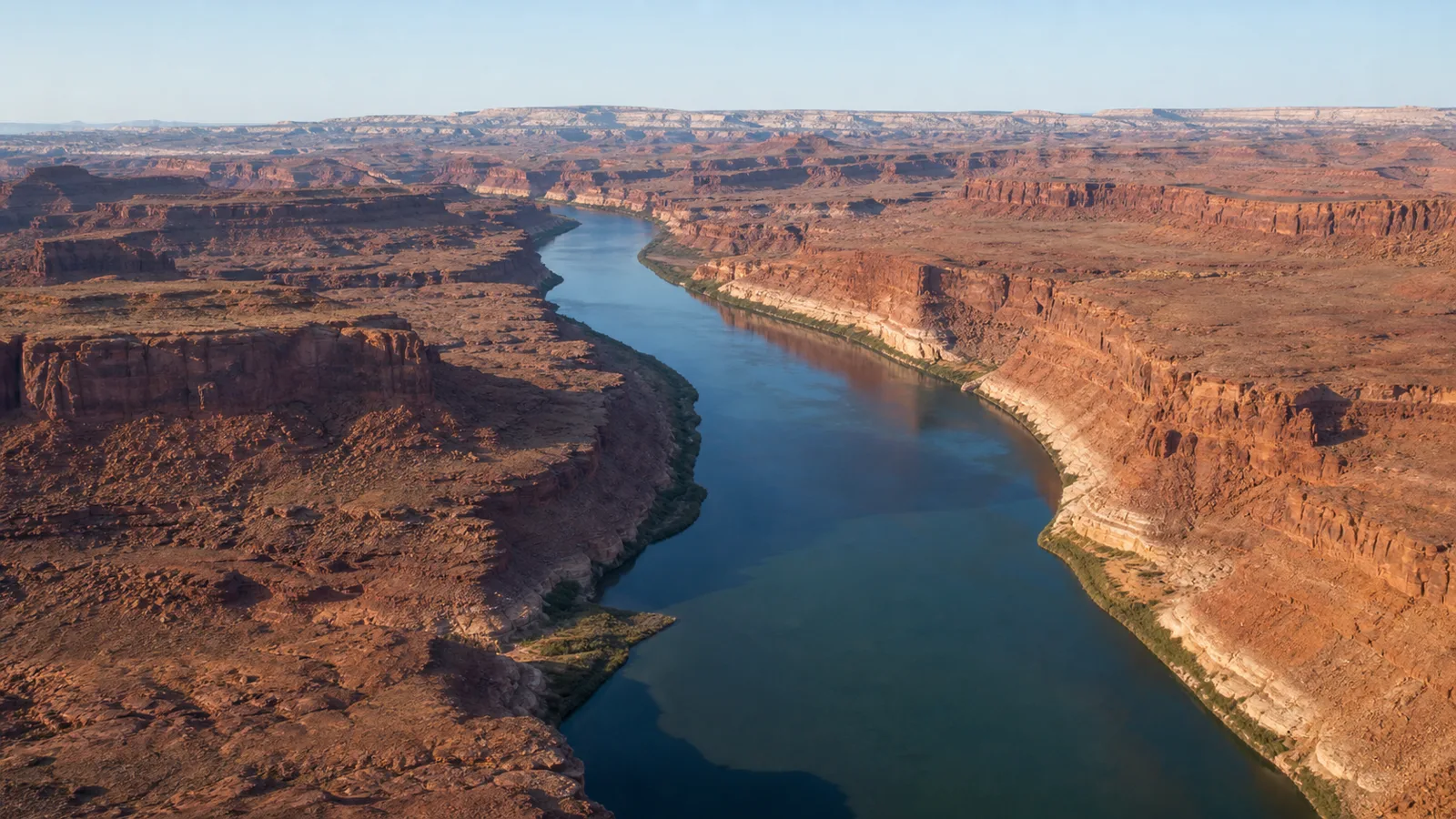
The Colorado River is not scheduled for a sudden federal takeover in December 2026. The federal government already operates Lake Powell, Lake Mead, and other major facilities, while states, Tribal Nations, Mexico, Congress, courts, and water users hold distinct powers and rights. What changes is the operating framework: temporary rules governing reservoir releases, Lower Basin shortages, drought responses, and U.S.–Mexico cooperation reach the end of their current terms in 2026.
As of July 22, 2026, the Bureau of Reclamation still lists a Draft Environmental Impact Statement with five alternatives and no preferred alternative. Interior has said it intends to finalize guidelines for operations beginning October 1, 2026. The decision will not determine who “owns” the river. It will determine how the system’s largest reservoirs are operated, how shortage risk is distributed, and which conservation tools survive into an era with less reliable water.
Research and policy status checked July 22, 2026. Reservoir figures and projections are dated because they change frequently.
Key takeaways
- The important federal operating date is October 1, 2026, the start of water year 2027—not a first federal seizure in December.
- The 2007 Interim Guidelines, the 2019 Drought Contingency Plans, and important temporary U.S.–Mexico measures reach the end of their current terms in 2026. The Colorado River Compact, federal statutes, court decrees, contracts, Tribal rights, and the 1944 U.S.–Mexico Water Treaty do not all expire.
- Reclamation’s Draft EIS analyzes five alternatives. As of July 22, it has not publicly selected a preferred alternative on its Post-2026 website.
- Federal power is substantial but uneven. Interior operates major federal infrastructure and has a particularly strong role over Lower Basin main-stem deliveries; it does not automatically own or control every water right and tributary.
- The physical crisis is immediate. In July 2026, Lake Powell was projected to end the water year near 3,516 feet, and total Colorado River system storage was substantially lower than a year earlier.
- Any durable solution must address hydrology, legal priority, Tribal water, Mexico, agriculture, cities, ecosystems, infrastructure, and the distribution of economic pain—not merely choose a reservoir formula.
Why 2026 matters
Three clocks are easy to confuse:
| Date | What happens | What it does not mean |
|---|---|---|
| October 1, 2026 | Water year 2027 begins. Reclamation says the post-2026 decision is intended to inform operations beginning on this date. | The federal government first acquires the river. |
| December 31, 2026 | The current terms of several temporary operating and drought-response arrangements end. Important U.S.–Mexico cooperative measures also reach their scheduled end. | The 1922 Compact, 1944 Treaty, Tribal rights, state rights, and every water contract disappear. |
| January 1, 2027 | The 2027 calendar-year operating period begins for Hoover Dam and Lower Basin deliveries. | Every user receives an immediate new cut or loses tap water. |
The December deadline is real, but it concerns an expiring layer of operating rules. The river is governed by a much larger body of compacts, statutes, court decisions, decrees, contracts, treaties, regulations, and agreements collectively called the Law of the River.
The Bureau of Reclamation’s Post-2026 page identifies three major temporary components ending in 2026:
- the 2007 Interim Guidelines, which coordinate Lake Powell and Lake Mead and establish Lower Basin shortage tiers;
- the 2019 Drought Contingency Plans, which added conservation and drought-response mechanisms; and
- international cooperative measures with Mexico developed under the 1944 Treaty, including provisions associated with Minute 323 and Minute 330.
That distinction matters. A replacement rule can profoundly alter releases, shortages, storage credits, and conservation incentives without rewriting every underlying legal right.
Is the federal government taking over the Colorado River?
No. “Takeover” collapses several different questions—ownership, allocation, priority, administration, and operation—into one dramatic but inaccurate word.
Interior’s authority is already extensive. Reclamation operates Glen Canyon Dam and Hoover Dam, which create Lake Powell and Lake Mead. The Secretary of the Interior administers contracts and deliveries from the Lower Basin’s main stem and has court-recognized discretion over Lower Basin surpluses and shortages. The Congressional Research Service describes Reclamation, acting for the Secretary, as the Lower Basin water master.
But federal authority is not uniform across the entire watershed:
- States administer many water rights, priorities, and tributaries under state law.
- Tribal Nations possess sovereign interests and federal reserved, treaty, settlement, or decreed rights.
- Mexico has rights under the 1944 Water Treaty, implemented through the International Boundary and Water Commission.
- Congress authorizes projects, appropriates money, approves settlements, and may be needed for operating mechanisms beyond existing agency authority.
- Courts interpret compacts, statutes, decrees, contracts, treaties, and the limits of administrative action.
- Cities, irrigation districts, utilities, and other contractors operate delivery systems and hold legal entitlements with different priorities.
The Draft EIS itself rejects simple claims of unlimited federal power. It says the full extent of Reclamation’s operational authority has not been tested through operations, legislation, or judicial review. It also says some components of the alternatives are within existing authority, while others would require new agreements or authority.
The accurate conclusion is therefore more consequential than the slogan: Washington already controls much of the system’s central machinery, but it must operate that machinery inside a layered legal order.
Why replacement rules are unavoidable
The legal deadline would be difficult even in a healthy river. It arrives instead during a long-running structural imbalance.
The Congressional Research Service reports that estimated natural flow averaged about 14.6 million acre-feet per year from 1906 through 2024, but about 12.4 million acre-feet from 2000 through 2024. It also reports that consumptive use has exceeded flow in most years, causing storage to decline.
An acre-foot is about 325,851 gallons. Yet the more important concept is not the conversion; it is the role of Lake Powell and Lake Mead as the system’s savings accounts. When use and required releases exceed inflow, the reservoirs absorb the deficit. A wet year can rebuild some storage, but it does not erase a persistent mismatch between average supply and demand.
Warming makes that mismatch harder to treat as a temporary drought. Higher temperatures change snow accumulation, soil moisture, evaporation, plant water use, and how much precipitation becomes runoff. A peer-reviewed synthesis published through the U.S. Geological Survey concluded that stabilizing storage under twenty-first-century runoff requires substantial reductions in use. Its estimates are scientific analysis, not a legally binding allocation, but the underlying warning is clear: reservoir rules cannot manufacture water.
What conditions looked like in July 2026
The latest official and operator data available for this article show why the timetable is under pressure:
- Reclamation reported that Lake Powell ended June at 3,525.17 feet, holding 5.60 million acre-feet, or 24 percent of live capacity.
- Reclamation’s July forecast placed water year 2026 unregulated inflow to Lake Powell at 3.50 million acre-feet, or 36 percent of average.
- The July 24-Month Study projected Lake Powell to end water year 2026 near 3,516.18 feet, with about 5.05 million acre-feet in storage.
- The Central Arizona Project conditions dashboard reported 19.13 million acre-feet of total system storage on July 19, down from 23.06 million acre-feet a year earlier.
- Lake Mead was operating under a Tier 1 shortage in 2026. Under the dashboard’s July most-probable assumptions, it was projected to end 2026 near 1,037 feet.
These projections are conditional models, not certainties. They depend on inflow forecasts, water orders, operating policy, and other assumptions. They should be read as a range of plausible operational outcomes—not as a weather prophecy.
The five federal alternatives, in plain English
Reclamation’s January 2026 Draft EIS executive summary analyzes five alternatives. The agency may refine them, combine elements, or develop additional alternatives before the Final EIS. The table below is a reader’s guide, not a substitute for the federal document.
| Alternative | Core operating idea | Central tradeoff |
|---|---|---|
| No Action | Revert largely to the annual framework that existed before the 2007 guidelines. Lake Powell releases would generally target 8.23 million acre-feet, subject to equalization and infrastructure limits; Lower Basin shortages would follow priority and top out at 600,000 acre-feet. | Required as a legal comparison, but not a continuation of today’s rules and poorly suited to the full modern problem. |
| Basic Coordination | Use a narrower framework designed to be implementable without new agreements. Powell releases would generally range from 7.0 to 9.5 million acre-feet; Lower Basin shortages could reach 1.48 million acre-feet and follow priority. | Offers a federal baseline if negotiations fail, but provides fewer storage and transaction tools and less flexibility. |
| Enhanced Coordination | Use combined Powell–Mead storage, recent hydrology, and broader conservation and storage mechanisms. Lower Basin shortages would begin at 1.3 million acre-feet and rise to 3.0 million acre-feet, distributed proportionally in the modeled framework. | Creates more adaptive and Tribal-water tools, but several mechanisms depend on cooperation, agreements, or additional authority. |
| Maximum Operational Flexibility | Manage Powell releases using seven-reservoir storage and recent hydrology, with a wide release range and Lower Basin shortages reaching as high as 4.0 million acre-feet in modeled conditions. | Gives operators the widest range of responses, but can produce large and uneven economic disruptions and is legally and institutionally demanding. |
| Supply Driven | Tie Powell releases primarily to 65 percent of the three-year average natural flow at Lees Ferry. Lower Basin shortages could reach 2.1 million acre-feet, with both priority-based and proportional distribution approaches analyzed. | Aligns operations more directly with available water, but leaves major disputes over compact obligations, shortage distribution, and who absorbs hydrologic risk. |
No alternative makes every group safer under every hydrologic future. Protecting Lake Powell can reduce releases toward Lake Mead. Protecting deliveries can draw down storage. Following strict priority can concentrate damage on junior users. Sharing cuts proportionally can conflict with legal expectations. Creating flexible conservation accounts can help the system, but only if the water is real, measurable, enforceable, and not counted twice.
What the final decision can change
Within its legal and operational scope, the post-2026 framework can shape:
- annual releases from Lake Powell toward Lake Mead;
- when Lake Mead deliveries are increased or reduced;
- the amount and distribution of Lower Basin shortages;
- reservoir triggers tied to elevation, combined storage, natural flow, or recent hydrology;
- storage and later delivery of conserved system and non-system water;
- conservation and operational activities above Lake Powell;
- protection strategies for critical dam infrastructure; and
- how annual operating plans translate policy into releases and deliveries.
These choices affect water supply, hydropower, electricity costs, agriculture, Tribal water use, municipal planning, ecosystems, recreation, and the probability that reservoirs approach critical elevations.
What the decision cannot automatically change
A federal reservoir decision cannot safely be assumed to:
- erase the Colorado River Compact or other interstate compacts;
- cancel every state-law water right;
- transfer every tributary to federal control;
- extinguish Tribal water rights or sovereignty;
- unilaterally rewrite the 1944 Treaty with Mexico;
- fund programs for which Congress has supplied no authority or money;
- implement every interstate storage, transfer, or conservation mechanism without participating governments and users; or
- prevent judicial review.
The practical effect can still be enormous. Operating rules can reduce a delivery, change a storage credit, alter a reservoir release, or trigger a shortage without transferring ownership of the underlying right.
Why the seven states remain divided
The conflict is often described as Upper Basin versus Lower Basin, but neither side is a single interest group.
Colorado, New Mexico, Utah, and Wyoming—the Upper Division states—argue that their users already experience hydrologic shortage when snow and streamflow fall. Many farms and communities cannot call on Lake Powell to replace missing headwater runoff. Upper Basin negotiators therefore favor rules tied closely to actual supply and resist an additional fixed obligation that they believe could count the same shortage twice.
Arizona, California, and Nevada—the Lower Division states—receive large scheduled deliveries through federal reservoirs and canals. They argue that saving the system requires measurable commitments from all seven states, not only reductions below Lake Powell. They also point to substantial conservation already undertaken in the Lower Basin.
The dispute intensified in spring 2026. On May 1, the Lower Division states proposed a short-term bridge through 2028 that described at least 3.2 million acre-feet of U.S. Lower Basin savings, including annual reductions of 1.25 million acre-feet in 2027 and 2028 plus additional conservation. The proposal is conditional and is not itself final federal policy. The Upper Division states continued to advance their own supply-driven concepts and called for mediation and renewed negotiations. In June, the Upper Colorado River Commission published correspondence showing that both the near-term bridge and a preliminary federal approach remained contested.
Underneath the public argument are harder questions:
- Should shortage follow legal priority or be spread proportionally?
- Does involuntary hydrologic shortage count the same as a negotiated reduction?
- How should evaporation and conveyance losses be assigned?
- How much water must move from Powell to Mead in exceptionally dry years?
- Who pays communities to conserve, fallow land, or change infrastructure?
- Which commitments are voluntary, and which can be enforced?
Litigation may eventually clarify authority, but courts cannot produce snow or refill a reservoir. That is why even parties confident in their legal case continue negotiating.
Tribal Nations are governments and right holders, not stakeholders at the edge
The Colorado River Basin includes 30 federally recognized Tribal Nations. They do not share one legal position, one infrastructure system, or one view of the federal alternatives.
Many Tribal rights are senior, but legal recognition does not guarantee that water reaches homes, farms, businesses, or ecosystems. Settlements, adjudications, pipelines, treatment systems, financing, storage authority, and rules for leasing or off-reservation use can determine whether a paper entitlement becomes usable water.
Post-2026 rules can affect how Tribal water is stored, conserved, credited, and delivered. The Draft EIS says Tribal input informed parts of the Enhanced Coordination alternative, but consultation with tribes is not the same as consent by every Tribal government. Any final framework should be evaluated nation by nation, with Tribal governments speaking for themselves.
Mexico remains part of the river system
The Colorado does not stop being international at the U.S. border. The 1944 Water Treaty generally provides Mexico 1.5 million acre-feet annually in normal conditions and does not simply expire in 2026.
What does reach a 2026 endpoint are important temporary cooperative measures developed through the International Boundary and Water Commission. Minute 323 addresses scarcity reductions, Mexico’s stored water, conservation, salinity, and environmental cooperation. Minute 330 expanded temporary conservation measures.
Reclamation’s domestic Draft EIS uses assumptions about deliveries to Mexico for modeling, but it explicitly says those assumptions do not establish U.S. treaty policy. A successor binational arrangement must be negotiated through the IBWC in consultation with the U.S. Department of State and Mexico.
What happens next
The ordinary federal path is straightforward on paper:
- Reclamation reviews public comments and updates its environmental analysis.
- A Final EIS identifies and analyzes a preferred alternative.
- Interior issues a Record of Decision explaining the selected action and legal basis.
- Reclamation incorporates the decision into annual reservoir and delivery operations.
- Separate agreements, contracts, legislation, state actions, Tribal agreements, or a new IBWC minute are completed where the selected mechanisms require them.
- Affected parties may seek administrative, congressional, or judicial changes.
The real sequence may be less orderly. Interior could choose a short bridge, phase in a longer framework, combine parts of several alternatives, or rely initially on the narrower tools it believes it can implement without new agreements. Emergency hydrology could also force operational decisions before every long-term dispute is settled.
What readers should watch
The next announcement matters less than the details behind it. When a preferred alternative or final rule appears, ask:
- What reservoir, storage, or flow triggers activate reductions?
- How large can annual cuts become, and who receives them first?
- Which provisions rely on existing federal authority?
- Which provisions require Congress, states, Tribal governments, Mexico, contractors, or new funding?
- How does the rule treat evaporation and system losses?
- Are conservation savings measured as real reductions in consumptive use?
- How are Tribal settlements, unused rights, storage, and infrastructure protected?
- What succeeds Minute 323 and Minute 330 for Mexico?
- How does the rule protect Glen Canyon Dam and Hoover Dam operations under worse-than-expected hydrology?
- When must the rule be reconsidered?
The pages most worth monitoring are Reclamation’s Post-2026 operations hub, Glen Canyon Dam status, monthly 24-Month Studies, and the IBWC minutes archive.
The bottom line
The Colorado River’s 2026 deadline is neither a hoax nor a scheduled federal seizure. It is the end of a temporary operating framework at the same moment that the physical system has very little margin for error.
Interior already has powerful levers over the river’s largest reservoirs and Lower Basin main-stem deliveries. The post-2026 decision will determine how those levers are used and how much room remains for negotiated conservation, storage, Tribal water, binational cooperation, and adaptation. But no operating formula can avoid the river’s central arithmetic: over time, use, losses, and legal commitments must fit the water that actually arrives.
References and further reading
Federal process and operating alternatives
- Colorado River Post-2026 Operations — U.S. Bureau of Reclamation; official process status, announcements, and document library.
- Post-2026 Draft EIS Executive Summary — U.S. Bureau of Reclamation, January 2026; five alternatives, authority discussion, and modeled effects.
- Interior Department Moves Forward on Guidelines Absent Full State Consensus — U.S. Bureau of Reclamation, February 14, 2026; October 1 schedule and federal process.
- Glen Canyon Dam Current Status — U.S. Bureau of Reclamation; current operations, inflow forecast, storage, and reservoir projections.
- Colorado River Conditions Dashboard — Central Arizona Project; dated system storage, snow, Lake Powell, and Lake Mead indicators based largely on Reclamation data.
Law, governance, and interstate positions
- Management of the Colorado River: Water Allocations, Drought, and the Federal Role — Congressional Research Service, updated November 19, 2025; legal history, allocations, federal role, hydrology, Tribal rights, and issues for Congress.
- Lower Division States’ Proposal for Short-Term Operations — Arizona, California, and Nevada, May 1, 2026; a party proposal for a bridge through 2028, not final policy.
- UCRC Correspondence With Reclamation — Upper Colorado River Commission, June 22, 2026; Upper Division proposals and responses concerning 2027–2028 and post-2026 operations.
Tribal and binational sources
- Tribes of the Colorado River Basin — Water & Tribes Initiative; overview of the Basin’s 30 Tribal Nations and water-rights context. Individual Tribal governments remain the authoritative source for their own positions.
- 1944 U.S.–Mexico Water Treaty — United States and Mexico; foundational binational allocation and administration.
- IBWC Minute 323 — International Boundary and Water Commission, 2017; scarcity, storage, conservation, salinity, and environmental cooperation through 2026.
- IBWC Minute 330 — International Boundary and Water Commission, 2024; expanded temporary conservation measures.
Hydrology and long-term balance
- The Colorado River Water Crisis: Its Origin and the Future — John C. Schmidt and colleagues, WIREs Water, 2023; peer-reviewed synthesis of storage decline and the scale of adaptation needed under twenty-first-century runoff.